Public datasets
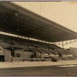
These are some rough 3D models of buildings that used to stand at the Marinewerfkade (now around Oosterdok). These historic buildings used to be part of the Marine Etablissement Amsterdam but were demolished in the 1960s for the construction of the IJtunnel. The 3D models were made in Blender and based on historic maps and images from the Amsterdam City Archives, which are referenced in the CSV. The models include (Screenshot_Front from right to left) the MarinePalace (Marine sleeping barrack called the Marine Palace, Dutch: 'Marinepaleis' or 'Officierspaleis', which existed roughly between 1882 and juli 1968); the MarineBetween (small factory building in between MarinePalace and MarineExercise, which existed roughly between 1942 and 1965); the MarineExercise (Exercise Barrack, Dutch: 'Exercitieloods', which existed roughly between 1909 and 1965); and the MarineSchool (School for the marine, Dutch: 'Marinemonteursschool' or 'Opleidingsschool', which existed roughly between 1909 and 1965). The 3D models were used in a thematic standalone version of https://3d.amsterdam.nl/ during an exhibition in the Architecture Centre of Amsterdam (Arcam).
License: CC BY
Interpolation map between modern value taxes, as found in data from the woningwaardekaart, and historic value taxes found in the 1832 cadastral data or the verpondingskohieren from the 17th century.
License: CC BY
The Amsterdam City Archives provide the inventory of the archive of the Amsterdam City Water Office (Stadswaterkantoor). This archive offers water level registers from 1601 up to 1841. This dataset provides the transcribed and transformed (from 'duim' into meters) measurements from the 9th of November until the 21st of November 1775. The measurements were taken in the IJ and in the city. The specific reason for the chosen time period is the flood on the 14th and 15th of November 1775. The city centre was spared from disaster (due to effective sluice management) but streets, houses and cellars near the IJ, e.g. in Kattenburg, Wittenburg and Oostenburg, were flooded. The dataset shows the 'normal' water level up to 7 days before and after the flood, which amplifies the extreme water levels during the flood.
License: CC BY
Related projects
‘Amsterdam in …‘ shows what publicly available linked datasets can be queried for both place (Amsterdam) and time (any year).…
Local Time Machines
Amsterdam is set to celebrate its 750th anniversary in 2025. Three years later, it will be exactly 100 years after…
Local Time Machines
Cinema Context is a historical data collection for the history of film culture, in particular the screening and distribution of…
Local Time Machines
Feeding the City: A Bird’s-Eye View over Amsterdam’s Food Supply from Its Hinterlands, c. 1550-1800 It is widely accepted that…
Local Time Machines

GLOBALISE (General Letters Ontology-Based AccessibiLity InfraStructurE, 2022-2026) aims to unlock the key series of documents and reports in the archives…
Local Time Machines
One of the aims of the Amsterdam Time Machine is to develop a 3D/4D urban model where socio-historical data about…
Local Time Machines
Historical and cadastral maps can enrich art historical research by allowing to pinpoint the artist’s workshop to a specific location…
Local Time Machines
The project ‘Living with water in Amsterdam’ aims to collect, study, and visualize historical data on the relation of the…
Local Time Machines
Datasets
Throughout history and across cultures, women are seen as destined for the home instead of the street. At the same…
Local Time Machines
The Virtual Interiors as Interfaces for Big Historical Data project focuses on the question of how we can develop and…